
On September 7, 1899, Karl wrote a letter to his sister Mattie from Wolseley, Assiniboia, NWT.
Today we know it as Wolseley, Saskatchewan, but in 1899, Wolseley was in the provisional district of Assiniboia, North-West Territories (NWT). The other NWT Districts included: Alberta, Athabasca, Saskatchewan (to the north of Assiniboia), Franklin, Ungava, Yukon, Mackenzie, and Athabasca.
Between 1905 and 1906, the districts of Alberta, Assiniboia, Athabasca, and Saskatchewan were reorganized to form the provinces of Alberta and Saskatchewan. Then, the hyphen was removed from North-West Territories to become the Northwest Territories, including Franklin, Ungava, Mackenzie, and Keewatin. In 1999, the Northwest Territories was reduced to its current size and the territory of Nunavut was created.

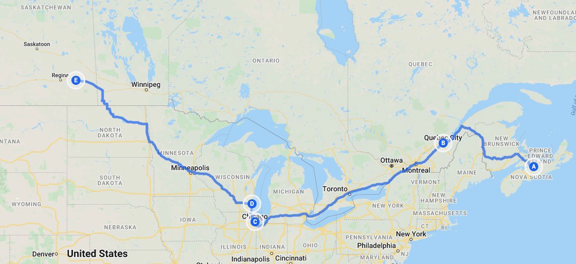
Given the changes in Canada between 1899 and present day, it seems like a good time to end this Karl Chronicle with a map. The following map documents where we’ve been up to this point, having travelled approximately 4500kms from Truro, Nova Scotia, to Wolseley, Saskatchewan.
Next week we will continue to travel through the Prairies in what was the District of Assiniboia, North-West Territories and what is now current day Saskatchewan.
In case you’ve missed them, click here for more Karl Chronicles